

More Than Meets the Eye
In 1914, the overall layout of the iconic town of Michel, B.C., was captured on film by an amazing photographer named Greene. Ferde Calvin Greene was born in 1882 and worked as a telegrapher for the Canadian Pacific Railroad on the western side of the Crow’s Nest Pass (Michel/Natal/Hosmer/Fernie). He met and married a Michel gal by the name of Elizabeth Gregory. His hobby was photography, and apparently he kept meticulous records of his camera experiments. He became a telegrapher for the Great Northern Railroad in Spokane and, around 1916, transferred to Columbia Falls, Montana. It is interesting to note that, at one time, the Great Northern Railroad ran from Rexford, Montana, to Michel. It was built by James J. Hill to challenge the CPR and hauled coal stateside from Michel, Hosmer, Fernie and Morrissey. It paralleled the CPR right to the south end of the Michel Creek valley.
Greene’s photographic legacy of lifestyles and events is mostly of northwest Montana from the mid-1910s to the 1940s. It is permanently housed at the Northwest Montana History Museum in Kalispell, from which one can purchase high-quality images online. I have chosen to review several of his important overview images of Michel taken in 1914 while he was there, as there is more than meets the eye in them. It is an interesting exercise to carefully study these images to understand just how Michel was laid out.
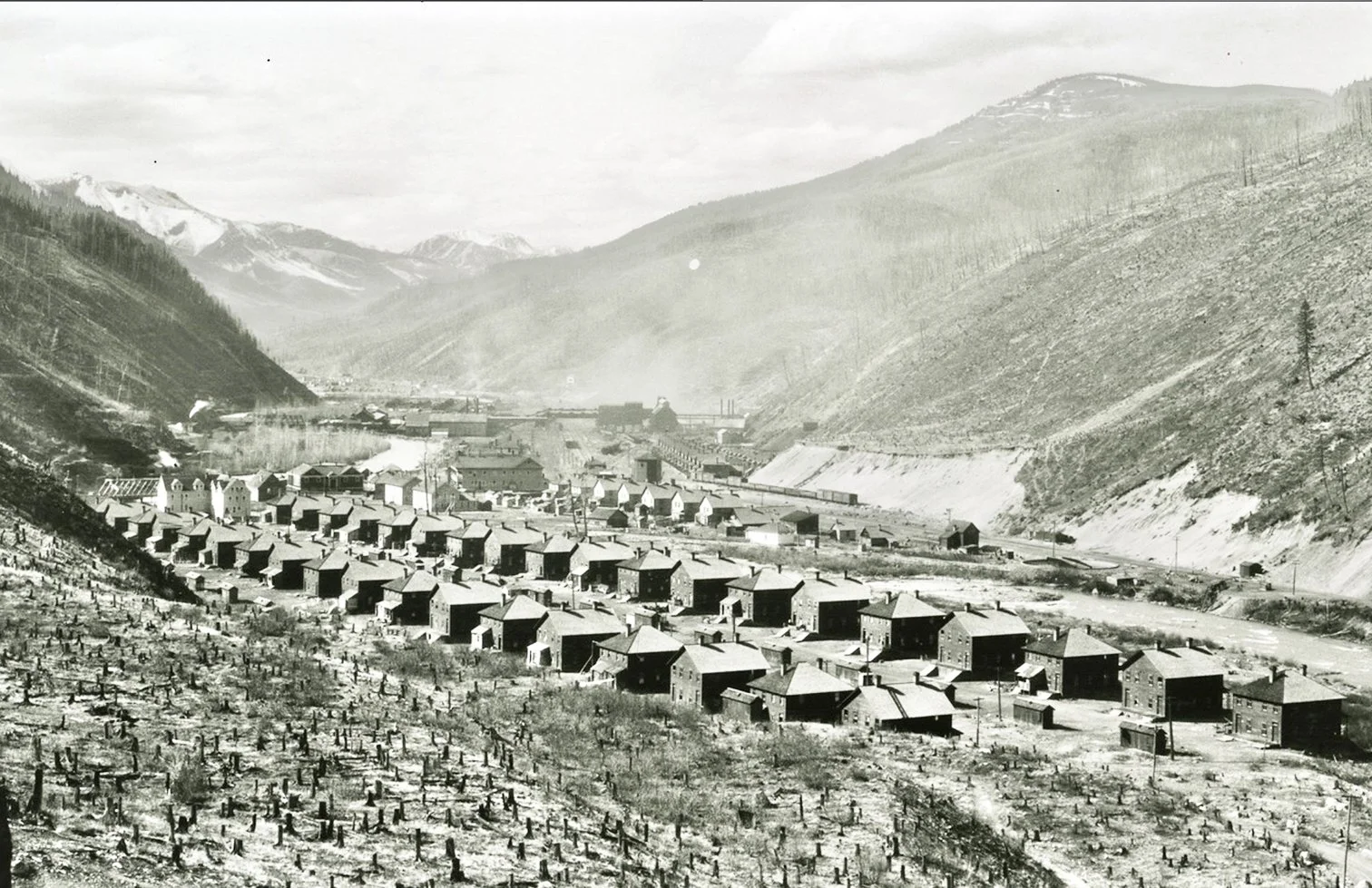
Michel looking north- In the foreground of the image we see 37 miner’s duplexes complete with double outhouses and to the right of them seven or eight single dwellings. Photo Credit: Northwest Montana History Museum
The boarding house that was converted into the hospital is the larger white building far left. Directly behind the boarding house the roof of a church under construction is just visible, which I believe was St. Pauls Anglican. In the centre of the photo the large tipple complex is visible. The hillside from where he took the shot is heavily logged off. Photo Credit: Northwest Montana History Museum
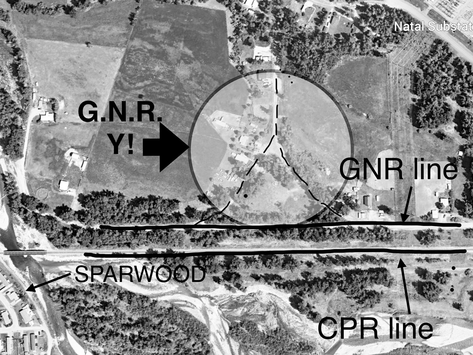
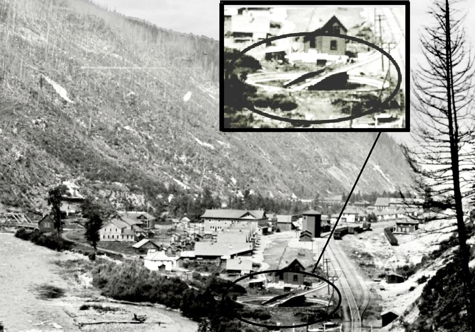
Looking further north- On the north side of Michel Creek one sees the all important water tower for the CPR station and directly behind it the giant Trites-Woods general store. At the far right below the tree is the end of the GNR line and south of that the CPR turnaround is visible. This rotated trains but the GNR could not use it so they built what they call a Y. It is exactly how it sounds, a Y-shaped track that could be used to turn trains around. It is visible on google earth (second photo above)just east of Sparwood. It works just like you driving into someones driveway and backing up so you can reverse direction. In fact, part of where the GNR line ran there is referred to today as the GNR road. Most of the highway you travel on going to Fernie is on the old GNR line and of course the tunnel before Elko was also where the line ran up until the 1920’s when it was abandoned. Photo Credit: Google Earth
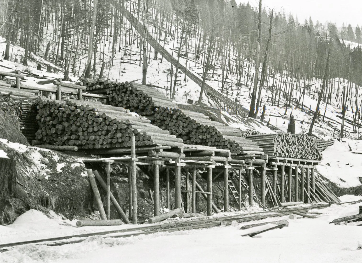
Mine Props - mine props or timbers were crucial to the operation of Michel underground mines and used by the thousands. Pictures taken from up on high reveal the slopes above Michel almost completely denuded of usable timber. It is uncertain as to whether they were logged after the famous fire of 1908 that burned throughout the Elk Valley or not. An innovative process is depicted in the picture of sliding logged timber down the slope to a timber yard using a chute. They also built trackways up the slope to lower timber down using large timber cars. Stockpiles of timbers are visible in many of his pictures. Photo Credit: Northwest Montana History Museum

Looking south towards Michel from the tipple bridge over the tracks- Probably one of the most fascinating photos I came across.. On the upper left are 8 or 9 duplexes the southern most of which was very close to the tipple. The CPR and GNR lines are very visible in the shot. On the right are nine houses that were commonly referred to as bosses row. The CPR tracks head straight for the station and then swing left just before it. It is clear that the GNR runs right in front of those duplexes on the left. What I find amazing is that dead centre in the picture (see circle) are five children walking south. Zooming in I found that they were two young girls in white dresses on the right and one child is holding a toddlers hand on the left. We have all heard of how it was in later years at Michel but this speaks to an earlier much cleaner time there. Photo Credit: Northwest Montana History Museum